It was all unintentional. I like hiking and mountains and especially volcanoes (all those years in Iceland have left a mark on me) but I wasn’t planning to be hiking most of the time in Indonesia. In the end, just by happening to be at the right places and meeting the right people, I ended up climbing eight volcanoes in Flores.
First off, here is a video (8 minutes if you have the patience) I made with time lapse photography from these volcanoes. Someone said it was nice.
Flores is one of the bigger islands along the Indonesian part of the “Ring of Fire”. There is a line of volcanoes, extending through the length of the country from Sumatra and Java through Bali, Lombok, Flores and the smaller islands to the east. Basically there is a major volcano every 20-30 km and they are all active and have erupted in recorded history, actually in most cases they still do quite regularly.


From east to west, the ones I visited are Ili Api (Lewotolo) on the island of Lembata, Ili Boleng on Adonara, Egon, Iya, Kelimutu, Ebulobo, Inerie, Wawo Muda. Unfortunately I did not climb one of the major volcanoes on Flores, Lewotobi because it had some signs of activity and was closed off for visitors. Otherwise it is a beautiful sight: it has two peaks – Lewotobi Laki Laki (“the husband”) and Lewotobi Perempuan (“the wife”). Of course, the “wife” peak is the more fierce and active one but because of her I couldn’t visit the “husband” either… The volcano had some very major eruptions and is even mentioned by Rudyard Kipling in one of his short stories. Kipling’s character however calls it “Loby Toby”, but he also calls sea gypsies “orange lords” (orang laut – “man of the sea” in Indonesian).
The first one I visited was Ili Boleng. Since I stayed with my friend Billy in a village on the slopes of the volcano, it was relatively easy to find my way. I already wrote about it here.
While looking for information on the internet for Ili Boleng, I found a website, called Gunung Bagging. Gunung means mountain in Indonesian and bagging is mountaineer lingo for “collecting” peaks. The website is very useful with relatively up-to-date information and what’s more important, GPS traces for many of the trails. There are two other major sources of good GPS data for trekking: WikiLoc and the trace collection of Open Street Maps (which I still don’t know how to search, so I just use google to search it). Then I use the excellent Open Street Maps in an app called OsmAnd for my phone, import the GPS trace, turn on the GPS and off I go. No guides needed and I don’t hire porters for such short walks (or any walks).
All the volcanoes I climbed in Flores were a one-day affair. They are not too high (most are under 2000 masl) but the trails were not always easy. In Indonesia trails seem to always go straight up the mountain, no matter how steep it is. And if you see any locals trekking, they will be wearing flip flops. Or nothing when their flip flops break. I saw many broken flip flops on the trails.
Most of these mountains see very few visitors. Locals are hardly ever interested in going up a mountain for fun (in fact few Indonesians would walk more than a few hundred meters unless they really have to and they would advise you to take a taxi for something that is two blocks away). Few foreigners make it here so trekking is by no means an industry. Most people who visit still seem to prefer to hire a guide from the nearest village. Now most guides in Indonesia are not what your idea of a guide might be. They are certainly cheaper than in some developed countries but here is where the good news ends. They might have never been to the mountain in question (or even to anywhere above sea level) even though they have lived next to it all their lives. They will most certainly not have any first aid knowledge or know what to do in case something happens. They will be late so forget about getting there for sunrise. They might slow you down due to the many smoking breaks. And they will probably not speak any English, so unless you speak some Indonesian you will have to be talking to yourself.
I chose to go without a guide, either alone or with a friend. There is phone coverage (Telkomsel is the only operator) almost everywhere.
When I was on top of Ili Boleng, I saw Ili Api on the neighboring island of Lembata and decided that I should go there too. Lembata is a nice island with few tourists. The only foreigner I met was an Italian, Marco, who had been traveling with his Indonesian friend on motorbikes all the way from Java but he had an accident on Lembata and was waiting there until his knee would get better. We had great chats. Finding a ride for early next morning to the start of the trail was no problem. In fact the ride found me. The local ojek boys smelled the newly arrived bule (foreigner) very quickly and a couple of them showed up in my hotel. Ojek is a motorbike taxi – you sit on the back. The guy was supposed to take me to the coastal village of Jontona where the trail starts and then the first five km up the mountain which he was sure would be doable by motorbike (“I’ve taken many tourists up that track”, he assured me). Well, the track was in really bad condition so he gave up half way but at least it was something. From there I walked the rest of the motorbike trail to the abandoned traditional village of Desa Lama and then followed the GPS way points from Gunung Bagging up the volcano making relatively slow progress through jungle, mud and swarms of mosquitoes. In three hours I was at the top, long after sunrise (the ojek guy came late!) but the views were amazing.
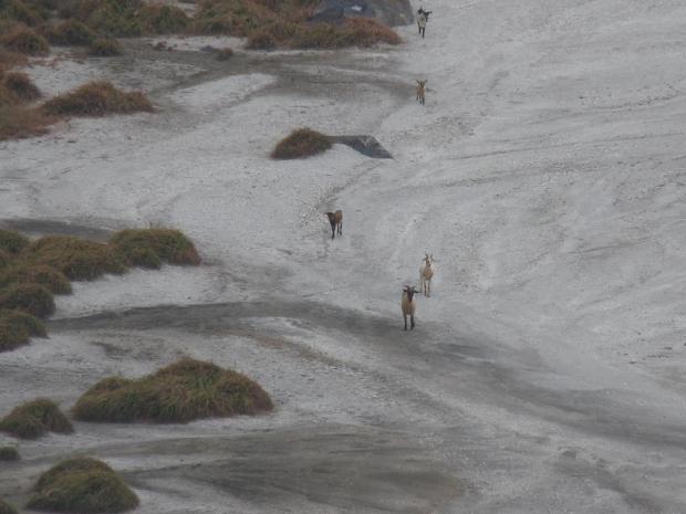
These goats were hanging out in the crater. Ili Api has one of the most beautiful craters of the Indonesian volcanoes I have seen.
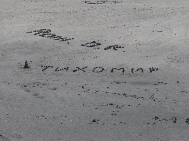
Since everyone else seemed to have set their name in stone in the crater, I thought why not. This is my name in Bulgarian (Cyrillic). (Get over it, Denise! :P)
On my way back from Lembata I thought of checking Couchsurfing for people to meet in Flores and I sent a message to a guy named Valentino from Maumere, the biggest town in Flores. He was not only the only active couchsurfer around, but he was also interested in climbing volcanoes too. We met in Maumere and while waiting a few days for my visa extension we went together to Egon, which is nearby and to the tourist-infested Kelimutu.
Egon is a relatively easy climb. You can drive a motorbike on an eroded road quite far up and then once you know where the trail starts, you might not even need the GPS trail (although finding the correct ridge to go down afterwards might be a bit tricky). The crater was really beautiful with a very active and loud fumarole and a lake in the middle of it all.
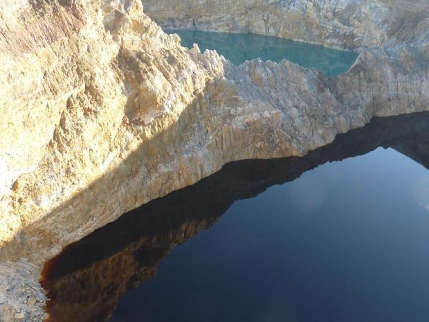
Kelimutu is the most popular tourist attraction in Flores proper. It has three lakes in its craters and these change colour regularly. Visitors to Flores usually come mostly to see Kelimutu. It is indeed a fantastic sight, especially at sunrise but that is also when most tourists congregate and it was an endless parade of selfies. Going to Kelimutu hardly requires any hiking. There is a road that goes almost all the way up. You pay entry fee, camera fee, vehicle fee and god-knows-what fee that is 10 times higher for foreigners than for locals and you get to see the tourists taking selfies with the colorful lake. Charging a camera fee is just as ridiculous as it sounds. Who doesn’s have a camera these days? They might as well charge a shoe fee or an underwear fee. Indeed, I have met some travelers who don’t have a camera and not even a mobile phone that can take pictures. And also some who don’t wear shoes (and possibly no underwear), so maybe I should stop giving ideas to the Indonesian government…
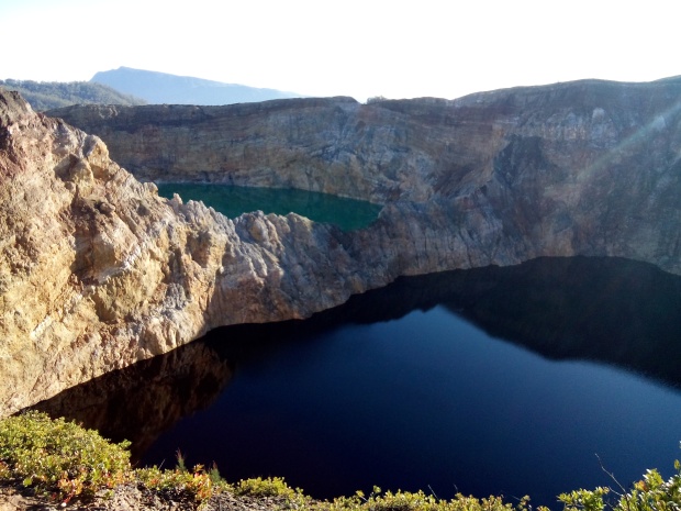
Kelimutu at sunrise. I managed to steal a second from the selfie-taking tourists to take this picture. My elbows did a great job…
After I got my visa extension I travelled further west together with Valentino on his scooter. Being a travel writer and photographer, he was interested in seeing more of his home island and really wanted to see two of the major volcanoes on Flores – Ebulobo and Inerie.
On the way there we stayed a couple of nights in Ende, which is the capital town of Flores. Right next to it there is a small volcano, merely 600 m high but with an incredibly beautiful crater. Mount Iya is easy to reach from Ende, very active and the crater drops steeply down to the sea.
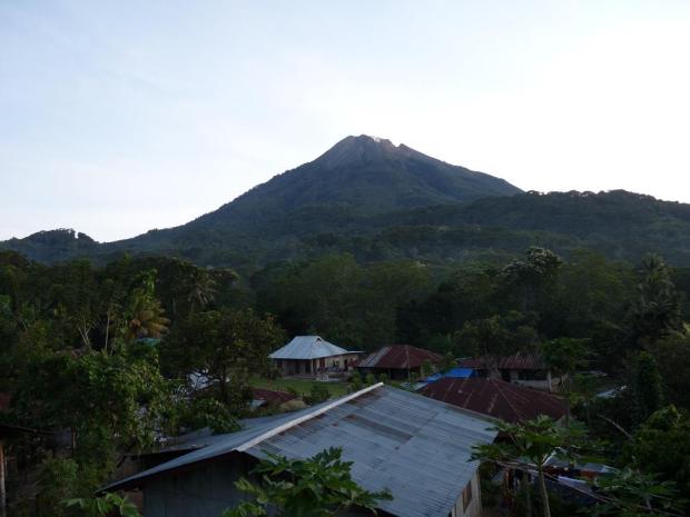
Ebulobo was one of the higher mountains I climbed. We went to the village where the trail starts in the evening planning to sleep a bit and then start the climb in the middle of the night
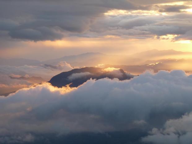
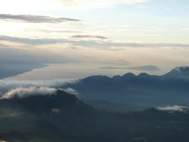
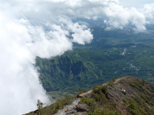
After some difficulties walking through the overgrown trail, we made it to the top for sunrise, which was initially cloudy but then an amazing panorama opened up.
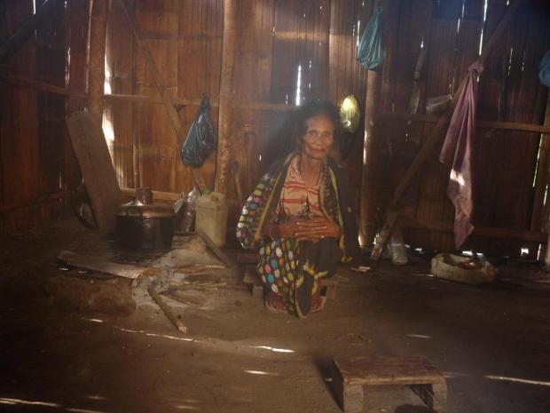
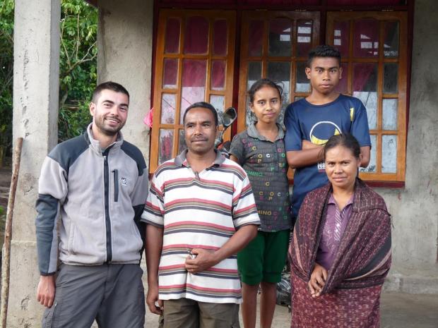
This lady hosted us in her house right where the trail up Inerie starts. We tried to camp but the dogs and kids soon found us in the bush and wouldn’t even hear about us sleeping in a tent. I think they even had a small fight about who is going to host us.
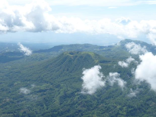
We set off in the middle of the night under a starry sky that soon turned very cloudy and it started to rain. We stayed under a tree for a couple of hours and when it didn’t get better we decided to give up and went back down, got some coffee and were ready to go when it suddenly cleared up and the volcano was visible once again. Valentino was too tired to climb so I went alone. The trail was ok, a lot of loose gravel towards the top (going down I was using my butt more than my feet) but the views were of course great. Probably the most challenging trail of all, but also the only place I met other people.
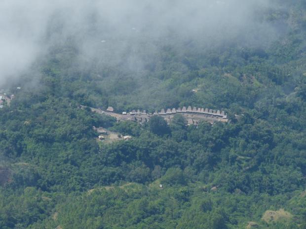
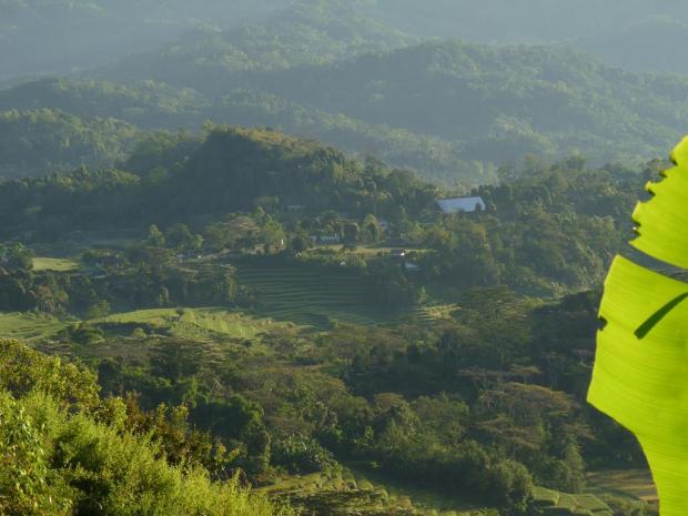
There are some traditional villages in the area that have been nominated for UNESCO listing. This is one of them from above.
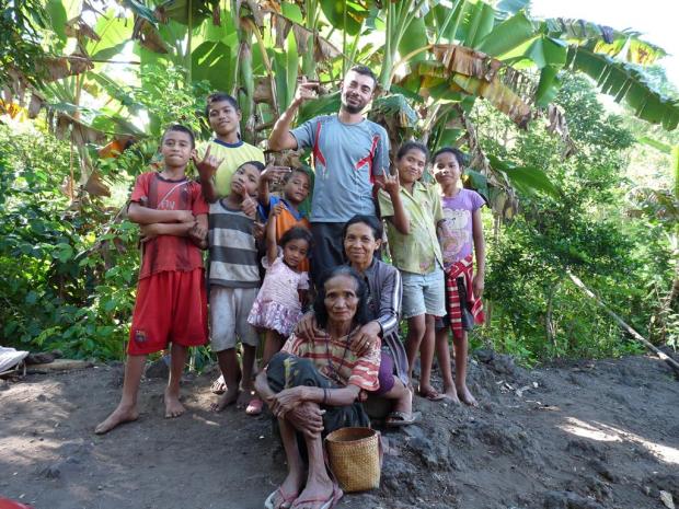
After going down, we had a small chat and headed off to a hot river for a dip. This is the good bye picture with the family of the old lady who hosted us.
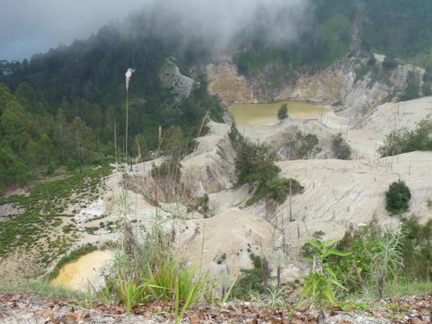
And this is the last volcano I saw in Flores. Wawo Muda erupted in 2001 in the middle of a hilly area and created this beautiful crater. It is easy to get there. From the town of Bajawa there is a road to a village and then it is a short walk to the crater.
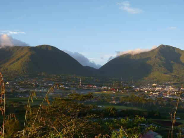
Next to the town of Ruteng, further west there is another volcano called Poco Ranakah which is also easy to get to as there is a motorbike trail almost all the way up. I was too exhausted by the time and didn’t go there but I went for sunrise to a small hill next to the town, Golo Curu, from where the views were fantastic. It was only 40 minutes on foot from the town.
Flores was not only about climbing volcanoes though. It is a really beautiful island to visit.
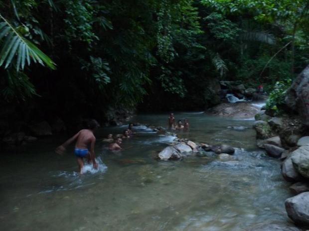
For lack of a better picture, this is where a (very) hot river mixes with a cold river and it is perfect for bathing. The locals love it and so do the few visitors. It was great after an exhausting climb of Inerie.
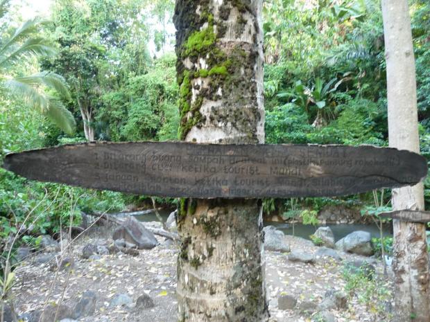
Some wise local made this sign with bathing rules. These were however not for tourist but for locals. It reads:
1. Don’t throw your garbage around. Put it in a plastic bag.
2. Don’t wash your clothes while the tourists are bathing
3. Do not stare at the tourists while they are bathing. Join them instead and practise your English!
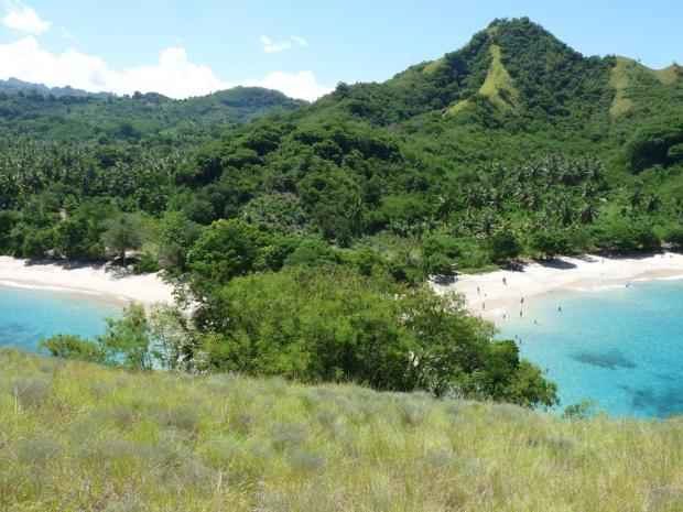
Pantai (beach) Koka is popular with locals but not with tourists. If you happen to pass by, stay a few days!
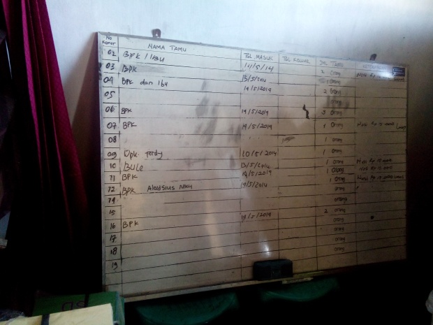
A typical registry of reservations in a Flores hotel. “BPK (Bapak)” means “Man/Mr”, “bule” means “foreigner” (in this case that was me in room 10)
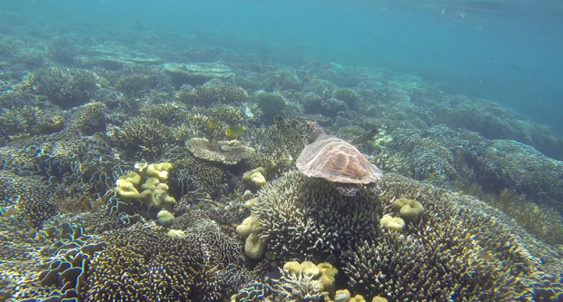
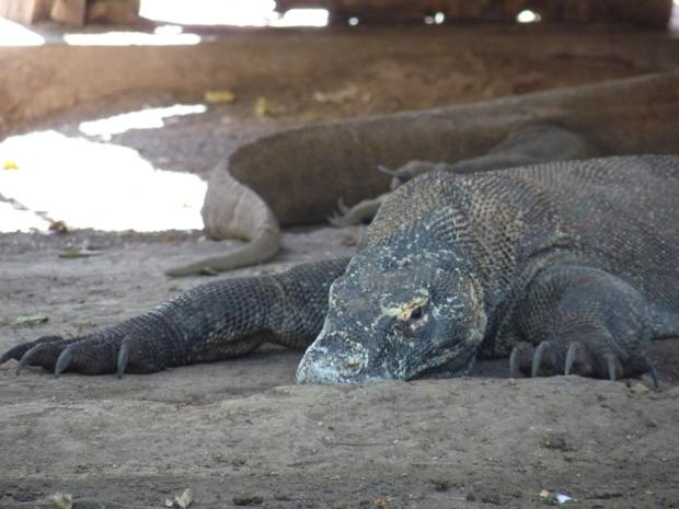
At the western end of Flores is the town of Labuan Bajo – the gateway to the famous Komodo National Park. I spent more than a week on a tiny beautiful island called Kanawa, licking my wounds (one of my toenails is about to fall off from too much hiking). This will be another blog post but here are some teasers:
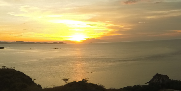
Sunset from Kanawa. The double peak in the distance, to the right of the sun is a volcano called Sangeang Api, close to Sumbawa. Who would have known that just a week later it would have a major eruption, disrupting air traffic in Indonesia and Australia. That happened on the day I was on the top of Tambora, the siteof the most powerful volcano eruption in recorded history. But that is another story…

I Love This. Thank You!
Woohoo!